Burcher Branch
Summary
| Track: | 53.77 km |
| Stations: | 0 / 5 in use |
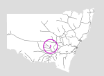
This is a relatively short (54km) line in the heart of NSW and within it's wheat belt. It currently is only used for grain, and hence only sees seasonal traffic. The lines runs north from the town of West Wyalong to the locality of Burcher.
| Name | Facility | Status | Opened | Closed | km | Links | ||
|
|
Wyalong Junction | Junction | In Use | 16-Dec-1929 | - | 558.120 | 1 | |
|
|
Wyrra | Station | Closed | 16-Dec-1929 | 6-Jul-1972 | 571.165 | 2 | |
|
|
Clear Ridge | Unknown | Closed | 16-Dec-1929 | 4-May-1975 | 578.330 | 3 | |
|
|
Lake Cowal | Station | Closed | 16-Dec-1929 | 4-May-1975 | 588.880 | 4 | |
|
|
Corringle | Station | Closed | 16-Dec-1929 | 6-Jul-1972 | 595.284 | 3 | |
|
|
Wamboyne | Station | Closed | 16-Dec-1929 | 4-May-1975 | 605.570 | 4 | |
|
|
Burcher | Station | Closed | 16-Dec-1929 | unknown | 611.890 | 6 |
Summary
| Track: | 53.77 km |
| Stations: | 0 / 5 in use |
| Section | Opened | Closed | Usage | ||
| Wyalong Junction - Burcher | 16-Dec-1929 | 4-Jul-2005 | 1 | general |