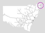
 |
Ballina Branch

Summary
| Track: | 20.64 km |
| Stations: | 0 / 6 in use |
The line opened in 1930 but passenger services ceased only 13 years later, on 16/4/1943. All services were suspended on 11/6/1948 due to landslides. The line was closed on 12/1/1949, and this was formally enacted in parliament on 14/10/1953,
Traces of the line are still visible along the Booyong-Teven Road. There are still remains of wooden pylons from the bridge across Teven Creek and the piers from the bridge across North Creek Canal near Ballina are still present.
| Name | Facility | Status | Opened | Closed | km | Links | ||
|
|
Booyong Junction | Junction | Closed | 25-Aug-1930 | 11-Jun-1948 | 856.230 | ||
|
|
The Halt | Platform | Closed | Mar-1940 | 12-Jan-1949 | 858.746 | 3 | |
|
|
Tyumba | Station | Closed | 25-Aug-1930 | 12-Jan-1949 | 862.145 | 1 | |
|
|
Nioka | Platform | Closed | May-1940 | unknown | 864.338 | ||
|
|
Teven | Station | Closed | 25-Aug-1930 | 12-Jan-1949 | 867.054 | 4 | |
|
|
Miroma | Platform | Closed | 9-Jan-1940 | 12-Jan-1949 | 869.166 | ||
|
|
Ballina | Station | Closed | 25-Aug-1930 | 12-Jan-1949 | 876.870 | 5 |

Summary
| Track: | 20.64 km |
| Stations: | 0 / 6 in use |
| Section | Opened | Closed | Usage | ||
| Booyong Junction - Ballina | 25-Aug-1930 | 11-Jun-1948 | 12 | general |
2 Track has been lifted