 |
Coolah Branch

Summary
| Track: | 42.47 km |
| Stations: | 0 / 7 in use |
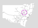
The Coolah branch is in the central north of the state. It extends from Craboon on the Gwabegar branch 38km through relatively flat country to the terminus at Coolah. The last train ran in 1982, but apart from the junction much of the infrastructure is still present 20 years later.
| Name | Facility | Status | Opened | Closed | km | Links | ||
|
|
Craboon | Station | Closed | 26-Nov-1910 | 6-Apr-1975 | 376.500 | 1 | |
|
|
Leadville | Station | Closed | 30-Mar-1920 | 6-Apr-1975 | 390.410 | 3 | |
|
|
Weeraman | Station | Closed | 30-Mar-1920 | 20-Apr-1968 | 395.800 | 3 | |
|
|
Hannahs Bridge | Station | Closed | 30-Mar-1920 | 6-Apr-1975 | 401.800 | 1 | |
|
|
Girragulang | Station | Closed | 13-Dec-1920 | 6-Apr-1975 | 407.900 | 3 | |
|
|
Tenango | Platform | Closed | 28-Oct-1943 | 21-Nov-1970 | 409.517 | ||
|
|
Coolah | Station | Closed | 20-Mar-1920 | 29-Jan-1986 | 418.970 | 5 |

Summary
| Track: | 42.47 km |
| Stations: | 0 / 7 in use |
| Section | Opened | Closed | Usage | ||
| Craboon - Coolah | 30-Mar-1920 | Oct-1985 | 1 | general |