 |
Parkes - Narromine Line

Summary
| Track: | 49.25 km |
| Stations: | 0 / 11 in use |
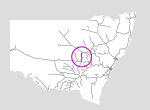
The Parkes-Narromine line forms a cross-country link between the Main Western and the Broken Hill lines.
Currently it provides a redundant route between the state's north and north-east with the west and south.
| Name | Facility | Status | Opened | Closed | km | Links | ||
|
|
Goobang Junction | Junction | In Use | unknown | - | 448.300 | 5 | |
|
|
Nanardine | Station | Closed | 30-Sep-1914 | 5-Jun-1976 | 457.900 | 3 | |
|
|
Goonumbla | Station | Closed | 30-Sep-1914 | 26-Apr-1976 | 465.600 | 2 | |
|
|
Alectown West | Station | Closed | 30-Sep-1914 | 23-Nov-1974 | 473.600 | 2 | |
|
|
Mickibri | Station | Closed | 30-Sep-1914 | 23-Nov-1974 | 482.362 | 3 | |
|
|
Trewilga | Station | Closed | 30-Sep-1914 | 23-Nov-1974 | 490.916 | 3 | |
|
|
Peak Hill | Station | Closed | 12-Dec-1910 | unknown | 498.400 | 4 | |
|
|
Myaroo | Loop | Closed | 2-Jun-1941 | 5-Jun-1976 | 513.860 | ||
|
|
Tomingley West | Station | Closed | 12-Dec-1910 | 26-Apr-1976 | 516.100 | 3 | |
|
|
Wyanga | Station | Closed | 12-Dec-1910 | 23-Nov-1974 | 528.990 | 3 | |
|
|
Fairview | Station | Closed | 12-Dec-1923 | 23-Nov-1974 | 539.200 | 2 | |
|
|
Narwonah | Station | Closed | 12-Dec-1910 | 23-Nov-1974 | 547.050 | 3 | |
|
|
Narromine | Station | Closed | 1-May-1883 | unknown | 497.554 | 13 |

Summary
| Track: | 49.25 km |
| Stations: | 0 / 11 in use |
| Section | Opened | Closed | Usage | ||
| Goobang Junction - Peak Hill | 30-Sep-1914 | general | |||
| Peak Hill - Narromine | 12-Dec-1910 | general |