Rankins Springs Branch
Summary
| Track: | 114.95 km |
| Stations: | 0 / 12 in use |
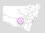
The Rankins Springs branch is another line serving the wheat fields of the state's central west. It extends from the town of Barmedman to the small township of Rankins Springs.
| Name | Facility | Status | Opened | Closed | km | Links | ||
|
|
Jct (Barmedman) | Junction | In Use | 8-Jan-1923 | - | 525.880 | 1 | |
|
|
Wargin | Station | Closed | 8-Jan-1923 | 4-May-1975 | 539.360 | 3 | |
|
|
Bellarwi | Station | Closed | 8-Jan-1923 | 4-May-1975 | 545.491 | 2 | |
|
|
Alleena | Station | Closed | 8-Jan-1923 | 4-May-1975 | 551.580 | 5 | |
|
|
Buddigower | Station | Closed | 8-Jan-1923 | 19-Jul-1975 | 563.920 | 2 | |
|
|
Tallimba | Station | Closed | 8-Jan-1923 | unknown | 577.290 | 3 | |
|
|
Buralyang | Station | Closed | 8-Jan-1923 | 4-May-1975 | 588.970 | 2 | |
|
|
Narriah | Station | Closed | 8-Jan-1923 | 4-May-1975 | 595.394 | 1 | |
|
|
Weethalle | Station | Re-used | 8-Jan-1923 | 24-Jun-1986 | 606.710 | 4 | |
|
|
Euratha | Station | Closed | 8-Jan-1923 | 4-May-1975 | 613.890 | 2 | |
|
|
Taleeban | Station | Closed | 8-Jan-1923 | 4-May-1975 | 622.262 | 2 | |
|
|
Erigolia | Station | Closed | 9-Jan-1923 | 4-May-1975 | 632.180 | 1 | |
|
|
Rankins Springs | Station | Closed | 8-Jan-1923 | unknown | 640.830 | 13 |
Summary
| Track: | 114.95 km |
| Stations: | 0 / 12 in use |
| Section | Opened | Closed | Usage | ||
| Jct (Barmedman) - Rankins Springs | 8-Jan-1923 | 4-Jul-2005 | 1 | general |